NEW MARK COORDINATE HISTORY REPORT
Victorian Survey Control Network (SCN) marks are readjusted over time, as geodetic surveys are undertaken across the state. This results in slightly different coordinates for a mark over time. Users can now view the history of these updates through the Mark Coordinate History Report.
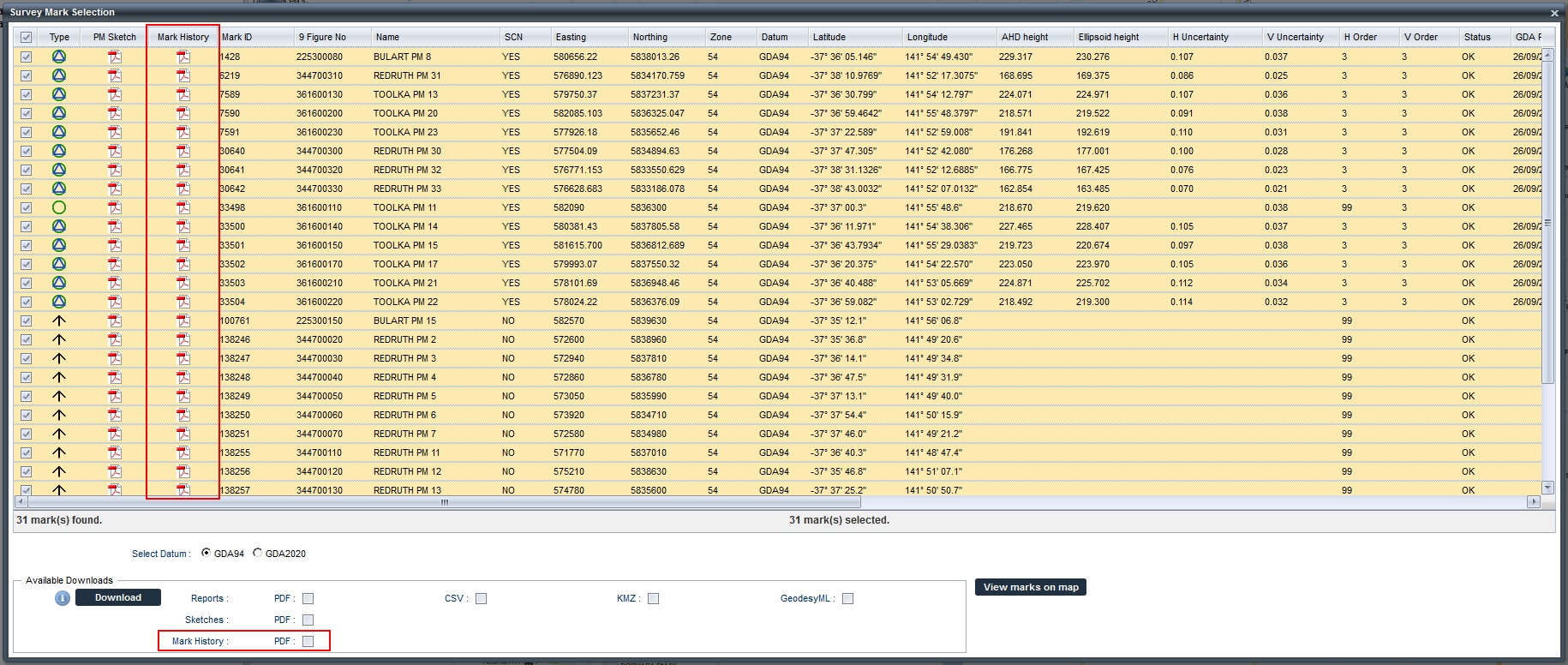
This new report is accessible from the "Mark Selection Window". A new column "Mark History" is added to the data table that allows the history of individual marks to be accessed/viewed. The history of multiple marks can be downloaded at once by selecting the marks for which the history data is to be downloaded and then selecting the "Mark History: PDF" option from the "Available Downloads" section of the "Mark Selection Window". This new functionality is highlighted below.

