plan zone and plan overlay information
Currently, the LASSI, LASSI-SPEAR and VICNAMES applications display the Planning Zone that applies to a parcel or a property in the "Identify Property" tab when a parcel or a property is identified using the "Identify Property" tool. We have improved on this functionality
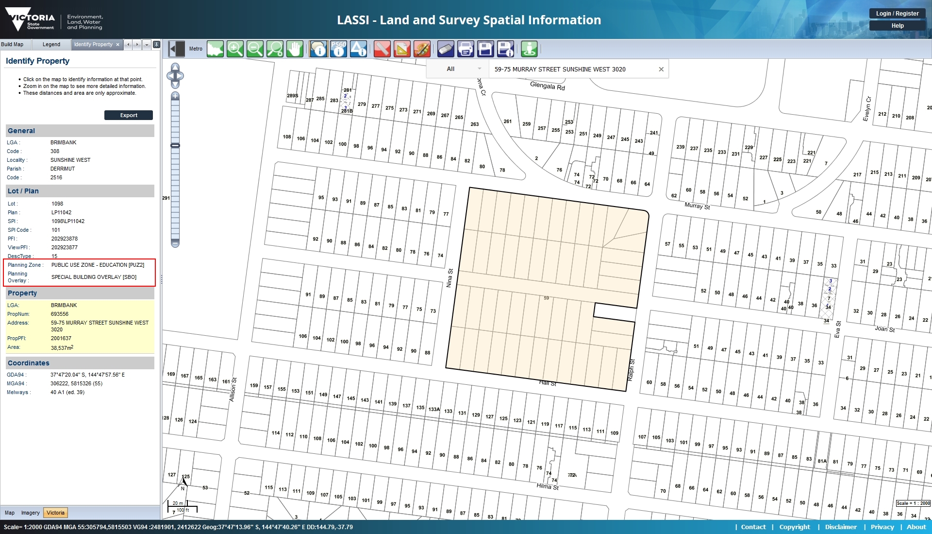
by adding "Plan Overlay" information as well to this section. Now, when you identify a property or parcel in LASSI, LASSI-SPEAR and VICNAMES, the identify property tab will also display all Plan Overlays that are applicable to the identifed parcel or property.
You don't need to enable any additional layers to view this information in the Identify Property tab. As you can see in the below image, all Plan Zones and Overlays that apply to an identified property/parcel are displayed in the relevant section of the Identify Property
tab.

LASSI already included two different map layers for "Plan Zone" and "Plan Overlays" in the "Build Map" tab that enabled these layers to be viewed on the map. However, until now, it was not easy to clearly identify these layers (when displayed on the map) as LASSI
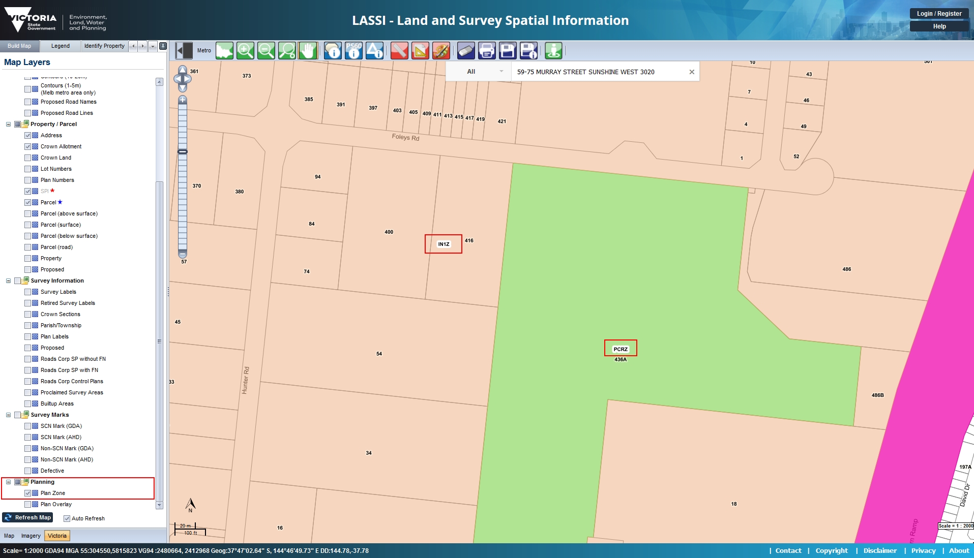
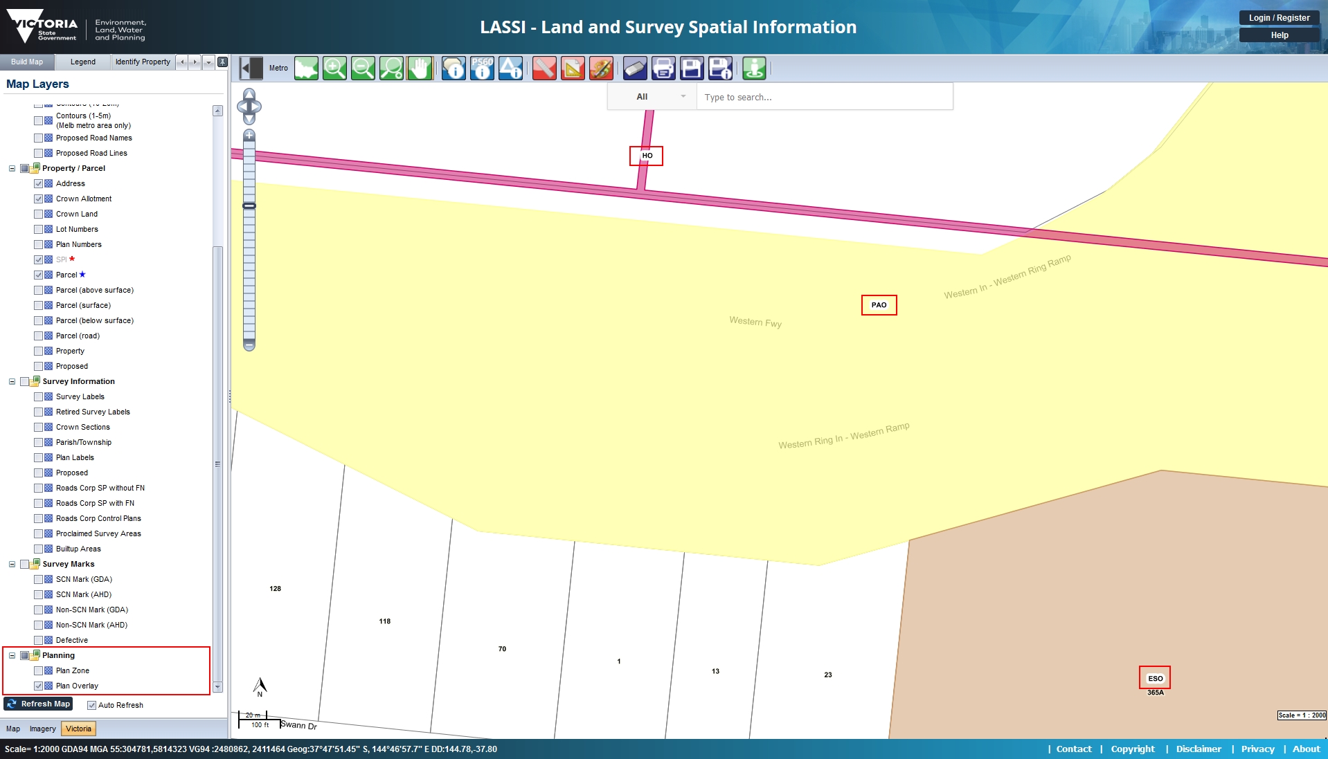
only displayed colour coded layer. With this release, we have improved this as well by displaying the relevant Plan Zone and Overlay codes on the map itself.
This image shows the Plan Zone codes being displayed on the map when the "Plan Zone" layer is enabled from the "Build Map" tab.

This image shows the Plan Overlay codes being displayed on the map when the "Plan Overlay" layer is enabled from the "Build Map" tab.

