what's new in this release for smes ?
The following features have been added in SMES :
- Dual zone coordinate support for marks along MGA Zone 54 and 55 boundaries.
- ‘View on Map’ feature for new mark coordinate validation (registered users).
- Improved validation features (admin users).
Dual Zone Coordinate Support:
Visual representation of the Zone Boundary for cadastral surveys in Victoria and Zone Boundary Buffer as two new layers in the Build Map tool pane under Survey Information.
For cadastral surveys in Victoria, the MGA zone boundary has been established such that Parishes lie wholly within either MGA Zone 54 or 55, as per Figure 7.3, Part 2, Survey Practice Handbook – Victoria.
This Zone Boundary follows the parish boundaries along the longitude of 144° and is shown as a solid green line.
Two vertical blue hashed lines represent the extents of the dual zone boundary (longitude 143°30’ to 144°30’) and the hatched area layer shows the dual zone area (Zone Boundary Buffer).
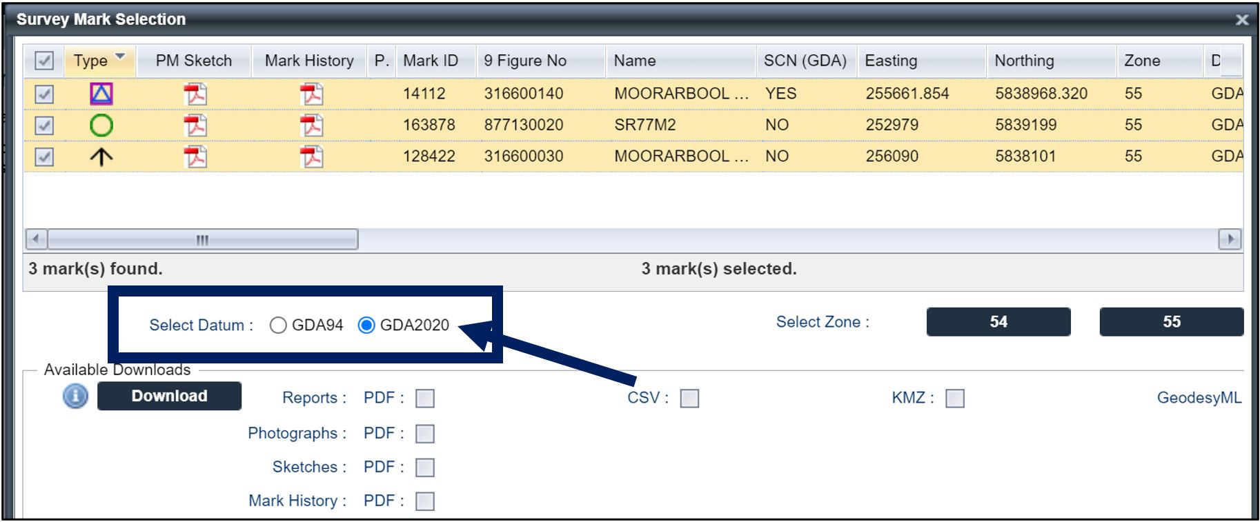
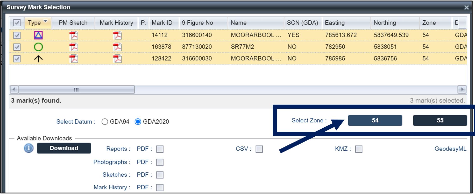
 Within the Display Mark Selection List Window, selected marks within the Zone Boundary Buffer area can be converted to their preferred zone coordinates using the Select Zone button
(set as either Zone 54 or Zone 55).

Select datum first, then Select Zone, otherwise everything is reset back to the original/default values.


'View on Map’ coordinate validation
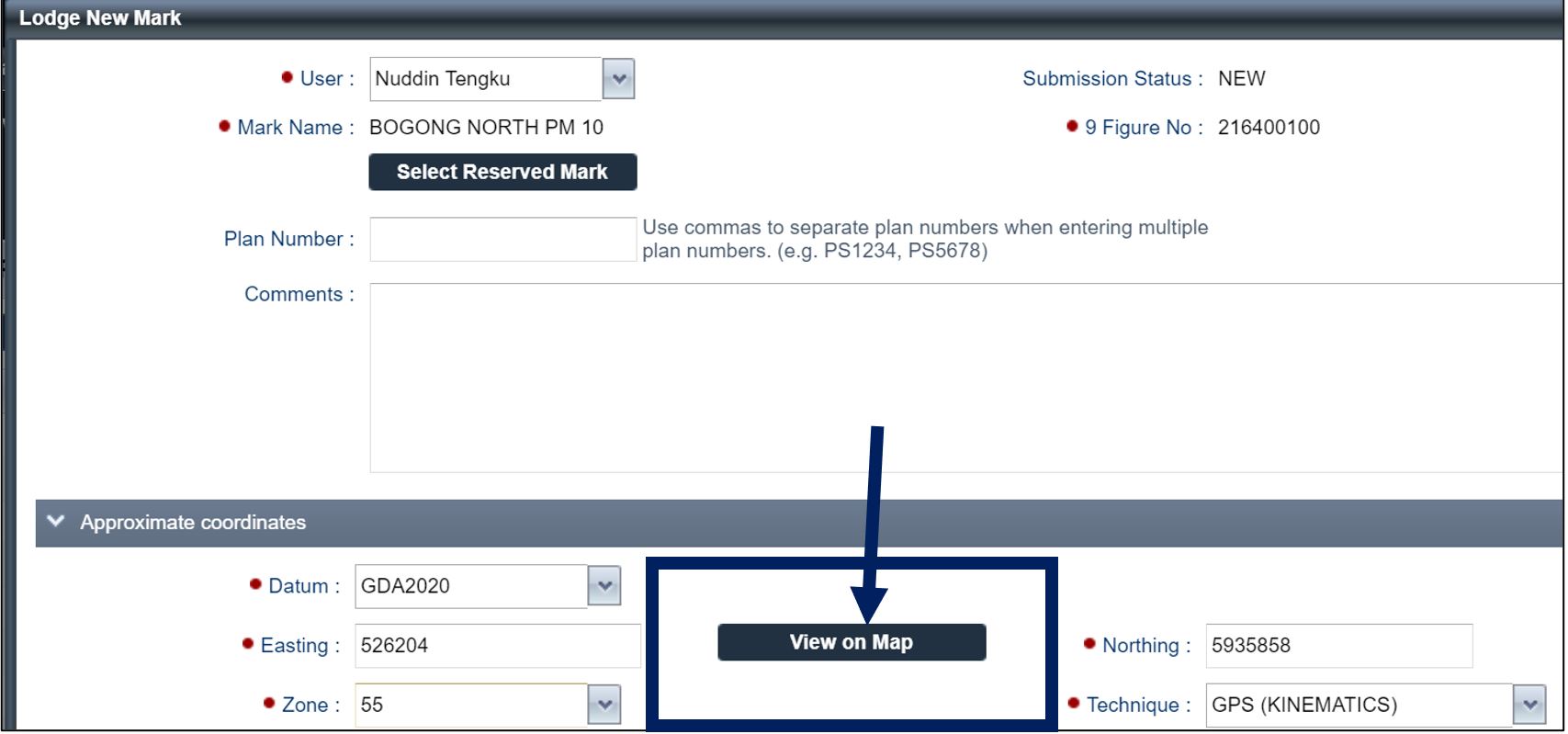
Registered SMES users will be able to visually validate the location of any new survey mark submission using the View on Map feature.
All attributes with red dots require input to access the View on Map feature.

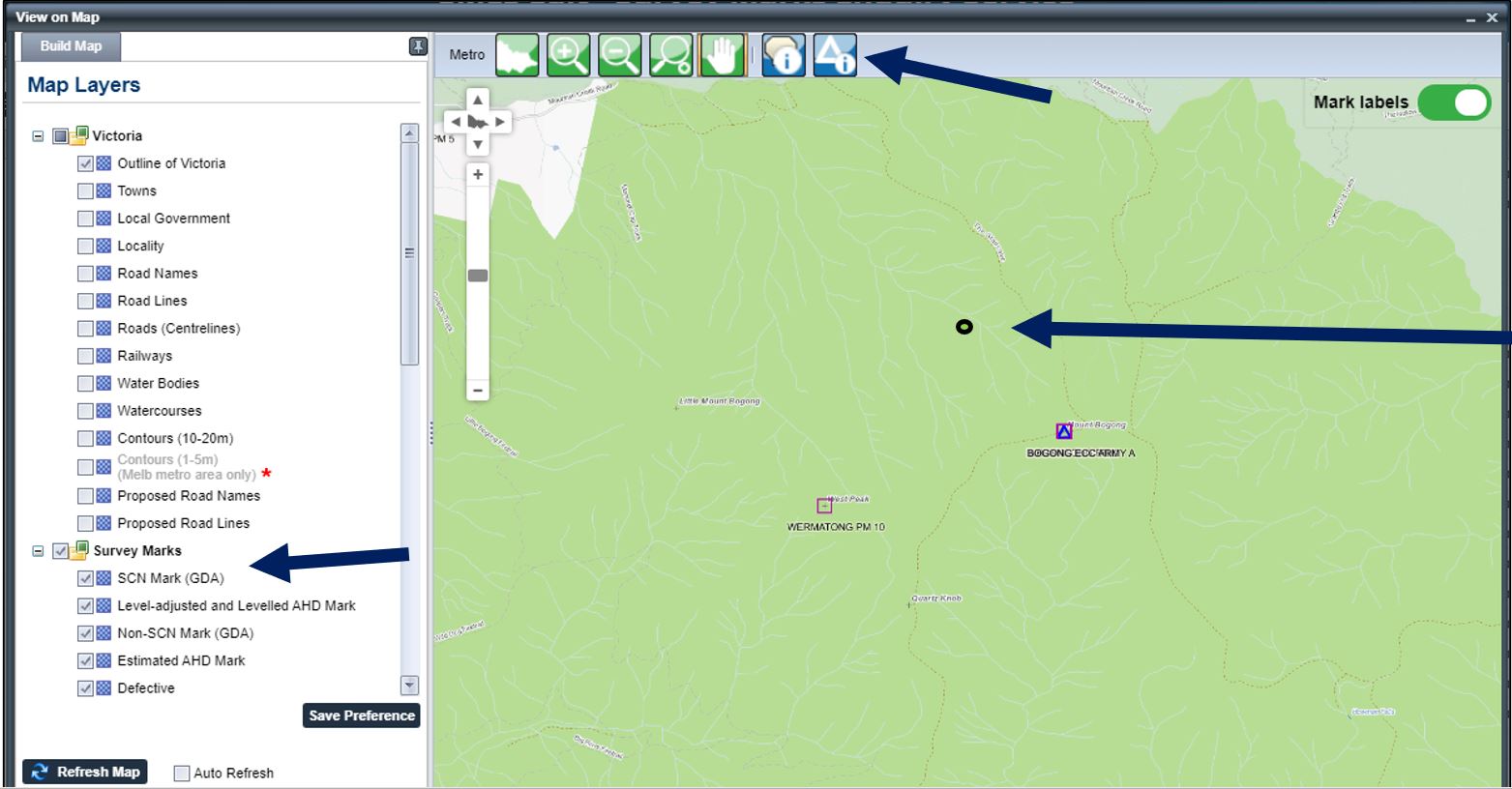
The View on Map feature plots the mark coordinate (as a small black dot) on a separate map window.
There are some map layers (e.g. Survey Marks) and basic tools (e.g. Identify Survey Marks) available in this window to access and use.

It is recommended that registered users use this View on Map feature to review their submission and ensure the location of the new survey mark matches the sketch plan and plots in the expected location.
Improved validation features for admin users:
- View on Map feature across several admin validation screens.
- Review map and sketches in one window.
